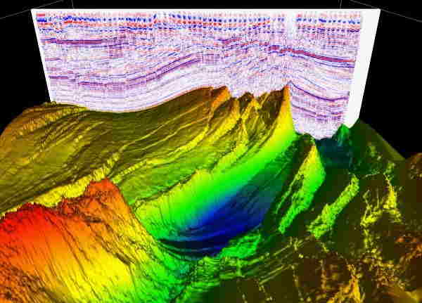
Welcome to StarTech

Oil & Gas Services

Drilling & Workover Services

 
img

SEISMIC ACQUISITION


Makamin is affiliated with StarTech. With the acquisition of its partner firm (GSC), Makamin now has access to the most advanced seismic equipment. The company is backed by the premier Seismic Exploration technology input/output company in the United States. In collaboration with INOVA USA, GSC-U K has acquired seismic field equipment capable of recording over 6000 channels 2d/3d Dynamite and/or using Vibroseis and the latest third generation Full wave digital 3D component Vectroseis geophones to record P and S waves. GSC-UK is always looking to extend its activities and welcomes the possibility to work on joint projects in the region.

Seismic Services

Services offered include:


-Seismic Reflection 2D/3D/4D using third generation full wave
-Recording Vectorseis RN technology from INVOA USA
- Shallow Seismic Reflection
- Seismic Refraction
- High Resolution Seismic Refraction
img

SEISMIC DATA PROCESSING

imageportofolio

For over 35 years, the company's processing expertise have worked in 2D/3D seismic data collecting, processing, and interpretation around the world. Tens of thousands of kilometers of 2D and 3D seismic data from around the world were processed and interpreted.
As explorationists, we understand that you value time and data quality; we recognized the following as probable requirements.


   Experienced explorers collaborate with innovative processing technology to:

  • increase signal to noise ratio (S/N) of the seismic data
  • lmprove continuity of the geological horizons
  • Remove possible false geological features
  • Derive the most accurate velocities for stacking and depth migration
  • Extract the best wavelet for seismic de convolution
  • Preserve the relative amplitude for direct hydrocarbon indication
  • Migrate and dip move out seismic data to tie the VSP and well logs

img

SEISMIC DATA INTERPRETATION


Our staff has a strong expertise in signal analysis for seismic applications, as well as extensive experience in the field. Our goal is to work for and with you as a team to create a true geological section.

SEISMIC DATA INTERPRETATION
GSC-UY. software provides 2D/3D interpretation packages that are executed interactively using the capabilities of a Hewlett Packard PC workstation. Landmark provides support for our software.

Services include:
  • -2D lnteractive package which allow tor complete interpretation of your processed seismic data together with possible integration of the geological information derived to produce final Interpreted maps in time and in depths. Also the user can perform post signal analysis for seismic attributes study. QC process is available at all phases of in terpretation-3D interactive package which is the state of the art 3D interpretation for all kinds of post processing signal analysis. Slices display in the time and/or in depth could be generated. Also to produce all kinds of interpreted maps 2D & 3D. Structural 3D Movie views are also available with QC possibly at any phase of the interpretation process
  • -Well log analysis and reservoir studies are available and integrated with the 2D/3D/4D seismic interpretation.
  • - The integrated geophysical and geological package results could be done for presentation and marketing packages.


SHALLOW GEOPHYSICS

Services offered include:

  • Depth to Bedrock surveying and mapping
  • Soil Sequence Stratigraphy imaging and mapping (clay, silt, sand, gravel, cobbles & boulders)
  • ln-Situ Material Properties Testing (eg. shear wave analysis, electrical resistivity, rock rippability The rippability of rock is controlled by numerous parameters including uniaxial strength, degree of weathering, abrasiveness, and spacing of discontinuities. Typically, weathered rocks, highly stratified or laminated rocks, and rocks with extensive fracturing are rippable.
  • 3D Subsurface imaging and Mapping
  • Buried Object Detection
  • Void Detection / Imaging• Shallow and Deep Oil/Gas Exploration
  • Groundwater Exploration
  • Lake/River Bathymetry, Ice Thickness

img

img

GEOTECHNICAL SITE INVESTIGATIONS


Makamin provides shallow geophysical surveying and data processing services to geotechnical and civil engineers tasked with conducting site investigations within the scope of their project llm1ts.
The data results we provide represent additional subsurface information required to understand what is happening between and beyond borehole locations in order to fully appreciate and understand insitu conditions. Based on expanded subsurface exploration coverage inside your project region, make more confident decisions and recommendations on behalf of your customer.

Field Tests:
  • - Upper bedrock surface profiling/mapping
  • - Soil sequence stratigraphy
  • - Soils characterization (clay, silt. sand, gravel, cobbles)
  • - Soil/rock profile geometry
  • - Soil/rock stiffness/hardness parameters
  • - 5011/rock resistivity parameters
  • - Fault detection and mapping
  • - Void detection and mapping

ENVIRONMENTAL INVESTIGATIONS


Makamin use shallow geophysics to identify, characterize, and map a wide range of anthropogenic (Man-made) subsurface structures and/or hidden dangers, such as:
  • Landfill boundaries
  • Buried drums
  • Contaminated soils
  • Graves, archaeological artifacts
  • Remnant building foundations
  • Buried pipelines, utilities, conduits
  • Voids

img

img

NON-DESTRUCTIVE TESTING


Makamin provides a number of geophysical technologies for measuring subsurface material qualities or scanning existing infrastructure. Specific Characteristics:
  • Shear wave velocity determination (in 1, 2 or 3 dimensions)
  • Electrical resistivity testing (cathodic protection/grounding studies)
  • Concrete imaging in 3·dimensions tor rebar/electrical conduit mapping
  • Detection of void space below concrete slab structures


LAND SURVEY

Makamin Land Survey Department has been involved in this field for the last i0 years through our partner firm (GSC) and has provided high-quality services during that time. The land survey department is staffed by well-educated and experienced technical personnel who use cutting-edge technology and equipment to provide the following services:

  • Land Surveying & Leveling
  • All type of Topographic Surveys
  • Corridor Alignments (Horizontal & Vertical) and Profile
  • Cadastral Surveys: cadastral surveys create, define, mark, and re-establish the boundaries and subdivisions of the public lands
  • Demarcation services: fixing the boundary or limits
  • Setting out Survey
  • Gate level computation services
  • Digital Terrain Modeling
  • Settlement Monitoring
  • Earthworks Volumes
  • Underground Utilities Survey
  • As-Built Survey
  • Establishment of Control Station & Bench Mark
  • Precise & Differential Leveling
  • Survey Consultancy and Check engineering
  • Hiring of Survey Crews
  • Aerial Control Mapping
  • Laser I 30 Scanning

img